Tag Archives: geography

Eila Campbell Memorial Lecture 2019

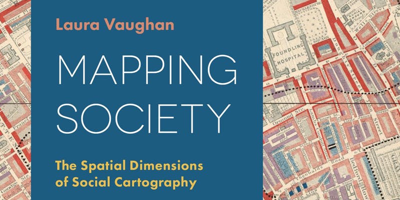
Ben Hughes, an MA Social and Cultural Geography student, shares insights from this year’s Eila Campbell Memorial Lecture given by Professor Laura Vaughan on her recently published book, ‘Mapping Society: The spatial dimensions of social cartography’.

Some people just love maps. Whether it be well thumbed road maps, atlases coloured by finger marks tracing mysterious routes, the rain-stained Ordinance Survey maps so beloved of ramblers, or big wall maps of the world – often with places of specific interest pinpointed, all maps tell a story. As fascinating and important as these physical maps are, they don’t capture – or reflect – the complexity of human existence. Addressing this is what lies behind social ‘cartography’, a technique first developed in eighteenth century to illuminate social issues. As a tool social mapping has grown in importance as a means of highlighting the spatial realities of a multitude of social and human features such as health, class, wealth, race and migration and the spatial distinctions they create.

Building on material from her recently published book, Mapping Society: The spatial dimensions of social cartography, the theme of Professor Laura Vaughan’s Eila Campbell Memorial Lecture spanned the most ‘recent’ 200 or so years of social mapping. She took us on a journey starting with a rare map of yellow fever in eighteenth-century New York to Charles Booth’s famous maps of poverty in nineteenth-century London; from an Italian racial zoning map of early twentieth-century Asmara, to a map of wealth disparities in the banlieues of twenty-first-century Paris.

Reflecting her background in architecture and her current role as professor at the Bartlett School of Architecture, Vaughan brought to life the spatial realities of social divides and inequalities that lie behind the concept of the divided city – a contemporary and timely area of study for human geographers. Drawing on current day human challenges such as climate change and (forced) migration, Vaughan identified the value of some of the emergent open source software packages such WorldMapper and GIS that are increasingly used in social media-led commentaries, around the social polarization of space.

The discussion highlighted many of the specific spatial issues that relate to social cartography. From the practical complexity of reflecting height vs breadth vs depth to ownership, and the inevitable power held by those controlling the production of maps, and so the stories that are portrayed, objectivity, recognizing that maps tend to be built on assumptions, perspectives or ideologies – e.g. is the UK really that big? Why are western nations often colored in calming pastels, when much of Africa and Asia is depicted as dangerous through use of stronger reds and oranges?

Also highlighted was the evolution of ‘non-literal’ maps, used to powerful effect by social geographer Danny Dorling and writer Rebecca Solnit, who sought to reflect human feelings and knowledge of place through maps that, in depicting social rather than physical actualities, result in distortions to the scale and shapes of physical places that we are all so used to.

It was telling that the discussion concluded with reflections on the increasing dominance of multi-national corporations such as Google, who through deployment of new satellite technologies are increasingly powerful in gathering data that is open to misuse and manipulation. With current algorithms able to instantly track and reflect your personal profile, Vaughan concluded with a note of both warning, that there is undoubtedly potential for an invidious market control, and hope, that these same technologies offer potential for counter-mapping to re-balance this.

Share

The 2018 Geography fieldtrip: spectacular landscapes and sun kissed beaches

Dr Sue Brooks discusses the Department of Geography Annual field trip to Mallorca where the group researched the Mediterranean climate, tourism and agriculture.

Farewell from the 2018 Mallorca field trip

What is there not to like about the Mallorca field trip? Let’s start with the Mallorcan landscapes, dating back to the Triassic and Jurassic geological periods (@250-150 million years ago) when warm sub-tropical seas allowed the deposition of sediments, shelly fragments and bones, all to be uplifted in the Alpine Orogeny, beginning 65 million years ago and still active today. The result is the landscape of the Trumantura National Park an area of amazing relief, geology and challenging transportation. It contains one of the most hair-raising drives in Europe, accessing Cap de Formentor, but that did not deter our coach driver, who took on the hairpin bends, steep ravines and determined cyclists in a calm and composed manner to get us to the Cap. Next was a trip to the golden sands of Formentor Beach and an ice cream, quickly followed by the wonderful market town of Pollenca, where we were rewarded by the view of Es Pla (central plain) and the rooftops of Pollenca after climbing the Calvery Steps. The final journey took us to the Monastery at Lluc for another ice cream, and then back to Santa Ponsa via the strategically important reservoirs of Gorg Blau and Cubert, constructed in the 1970s to help with water supply across the island.

Students were engaged in learning about tourism, agriculture and water supply set within the context of the natural landscapes. One task was producing an isohyet map to show the spatial distribution of rainfall across the island while at the same time discovering that the Mediterranean climate presents some considerable challenges through its temporal distribution of rainfall and the mismatch to tourism demand. There was plenty of time for group work with projects on Santa Ponsa beach and in the ephemeral torrents that are so typical of the island.

Hard work in progress back at the hotel

Project hand in was set for 5pm on the last day and everyone worked very hard to meet this deadline, before a relaxing evening with some travelling to Magaluf to join the fun there. Some students decided to stay on for a holiday and to fully appreciate the diverse and spectacular landscapes of the island. Thank you to all our students for your hard work, dedication and exemplary behaviour on the field-trip. We look forward to welcoming next year’s cohort for another wonderful experience.

Share

Maps, Wolves and Riots: All in a day’s work on a Birkbeck Field Weekend

This post was contributed by Dr Sue Brooks, Dr Rosie Cox, Dr Becky Briant, Dr Andrea Ballatore and Dr Kezia Barker from Birkbeck’s Department of Geography, Environment and Development Studies

The Cambridge Backs in Autumn (photo S Brooks)

The Cambridge Backs in Autumn (photo S Brooks)

On a glorious autumn weekend large tracts of East Anglia were dotted with roving groups of undergraduates from the Department of Geography, Environment and Development Studies. New students had been with us for just three weeks when they were treated to an extravaganza of delights, taking in the stunning wildlife at Wicken Fen Nature Reserve, exploring the market city of Ely and ending up in the fast-paced urban landscape of Cambridge. The new students were able to apply their learning from lectures and readings and test the lecturers’ knowledge of their outdoor environments as they developed new skills in field studies and spatial analysis.

Learning about an ancient landscape (photo A Ballatore)

Learning about an ancient landscape (photo A Ballatore)

Wicken Fen has some of the best preserved wetlands in the whole of Europe, allowing people to see at first-hand what the ancient Fenlands looked like before they were drained for agriculture. Through a series of probing questions the students kept the reserve’s ranger, Maggie Downes, on her toes as she outlined the National Trust’s future vision for Wicken Fen, including the use of Highland cattle and Konik ponies as ecosystem engineers in an exciting rewilding experiment. Students were also reassured that rewilding advocates do not plan to reintroduce wolves in Cambridgeshire. The day ended in Ely, with a look around the ancient cathedral and some socialising in the evening.

Inside Ely Cathedral (photo A Ballatore)

Inside Ely Cathedral (photo A Ballatore)

The following day, supported by modern digital media and GPS sensors, students collected data about the vegetation and wheelchair accessibility of diverse areas of Cambridge. The data was then used for the production of maps. The social interactions were lively, to say the least, and the results of the photography competition have yet to be announced!

picture1

Vegetation mapping along St Barnabas Road, Cambridge

Vegetation mapping along St Barnabas Road, Cambridge

picture3

Wheelchair accessibility mapping (accessibility level represented as green, yellow, and red)

Wheelchair accessibility mapping (accessibility level represented as green, yellow, and red)

Exploring accessibility in urban spaces in Cambridge (photo B Briant)

Exploring accessibility in urban spaces in Cambridge (photo B Briant) 

Meanwhile Geography and Environmental Management students entering the final year of their BSc programmes were out and about exploring the Fenlands of East Anglia. Stepping out into the wider Fens that exist today, students were able to engage with debates about landuse conflict, water management, water abstraction, fisheries and the threat of accelerated sea level rise on vast areas of grade A agricultural land lying at or below sea level. A highlight of the day was a chance encounter of the author Rob Reed, who recounted in graphic detail the Littleport Riots of 1816 which he had recently been researching for his book Rebels with a Cause, published this year.

The Denver Complex (left) and cut-off channel (photo S Brooks)

The Denver Complex (left) and cut-off channel (photo S Brooks)

Finishing at the Denver complex, where tidal water from the sea meets the river outflow from land, really focused minds on issues associated with management of the river Great Ouse and the Ouse Washes, set within the fourth largest river catchment in the UK. Our coach driver, Dee, brought us all safely home in her inimitable way with lots of humour and good fun. Students were happy and notched up many useful skills to take them through their degree and beyond.

The Unmanaged River Great Ouse upstream of Earith Sluice and Hermitage Lock (photo S Brooks)

The Unmanaged River Great Ouse upstream of Earith Sluice and Hermitage Lock (photo S Brooks)

What our students said:

“What I would say about the Fenland trip is that it was fascinating to learn about a part of the country I have never been to (and maybe never will again?!). Friends and family I’ve spoken to have only ever, at best, passed through it, but when I’ve explained to them how for hundreds of years we’ve massively modified the landscape there to reclaim it from the water, they have wanted to hear more about the feats of engineering used” Lisa Howard, BSc Geography


“As per usual this was a great learning experience, I find it’s much easier to learn things whilst I participate in fieldtrips” Margareta Vutescu, BSc Environmental Management


Share

PhD Chocolate Tasting

Chocolate is often an integral, but rarely acknowledged, part of the PhD process. As part of their transferable skills training for PhD students, the Department of Geography, Environment and Development Studies (GEDS) decided to explore this further, with a chocolate tasting session run by Anthony Ferguson of Niko B Chocolates. The session was introduced by Kate Maclean and Rosie Cox, whose opening talks framed the session in terms of the relationship between taste, food and embodied knowledge. Following a geographical theme, students and staff tasted chocolate from around the world, and learnt to distinguish the multiple taste and texture sensations of chocolate truffles.

Share