Tag Archives: geology

Volcanoes without borders

Neill Marshall, undergraduate Geology student, discusses a recent event on diplomacy in scientific research, as part of Birkbeck’s 2018 Science Week.

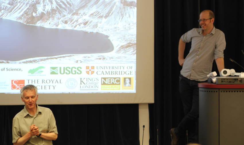
Studying Earth Sciences offers unique opportunities to travel to remote and exciting places around the world, and this has certainly been the case for geophysicist Dr James Hammond. As part of the #BBKScienceWeek 2018 talks, Dr Hammond presented his work on Mount Paektu, a remote volcano straddling the North Korean and Chinese border. He spoke of the unique experience of studying a poorly understood active volcano capable of catastrophic eruptions that has a significant cultural importance to all Koreans.

The cultural significance of Mount Paektu

Mount Paektu is the highest point on the Korean peninsula with importance to all Koreans as a strong-hold against the Japanese invasion. Dr Hammond described how it is the symbolic birthplace of the communist revolution and Kim Jong-il was thought to have been born there. Now many North Koreans go on a pilgrimage to Mount Paektu to rejoice in their leader’s birthplace. Dr Hammond showed videos of performances of the mass gymnastics at the Arirang Festival depicting Mount Paektu and of school children singing songs about the volcano.

Geopolitics and science diplomacy

Studying a volcano in a politically volatile region rarely visited presented Dr Hammond and his colleagues with logistical and diplomatic challenges. Following the increased activity at Mount Paektu, North Korea called out for collaboration with world scientists. It took two years of negotiation between the UK, US and North Korean governments with involvement from the Royal Society and the AAAS before a joint North Korean-UK scientific expedition could be mounted.

Dr Hammond and his colleagues became the first western scientists to visit the Mount Paektu volcano observatory. Dr Hammond described how the project ultimately enabled scientific communication with North Korean scientists allowing knowledge to be shared between this politically isolated nation and the wider scientific community outside North Korea.

Scientific interest in Mount Paektu

Dr Hammond gave a brief background on the eruptive power of Mount Paektu describing the last large eruption in 946AD as one of the biggest eruptions in human history. He described colossal eruption, bigger than Krakatoa in 1883 and on a similar scale to the Tambora eruption in 1815, with deadly lahar and pyroclastic flow deposits in the region.

Despite the scale of the 946AD eruption little is known about the volcano. It does not lie on a tectonic plate boundary unlike the vast amount of volcanoes on Earth.

Recent activity has been observed at the volcano in the form of earthquakes, increased gas emissions and deformation of the volcano. These are key indicators that the magmatic plumbing system is recharging.

The deployment of seismometers in a linear array was an attempt to use seismic waves to image the Earth’s crust near to Mt Paektu. He explained the processes involved in deployment; meeting local farmers, dignitaries and North Korean scientists; dealing with mountain weather; and travelling in this remote region.
Dr Hammond explained how seismic waves can be utilised to image the Earth in a similar way to a CT scan of a human body. From this method of imaging, a low seismic velocity zone was found 7km beneath the surface was found. Combined with other analysis of seismic velocities the results suggest the presence of fluid (likely magma) in the crust beneath the volcano.

However, more research needs to be done to fully understand the volcano with the key question of why this volcano is present in this region is still yet to be answered. Dr Hammond is planning an additional wider deployment of seismometers (potentially in 2019) to try and answer this question.

Share

Science Week 2017: understanding climate change

This blog was written by Giulia Magnarini, Birkbeck graduate in Planetary Sciences with Astronomy and PhD candidate in Earth Sciences at UCL.scienceweekclimatechange850x450To understand current climate changes, we need to understand past events. However, using our existing climate model is really difficult.’ This is how Professor Andrew Carter began his talk on Earth’s long-term climate. Professor Carter’s research focuses on studying Antarctica in terms of climate changes.

Despite some persistent denial, evidence for an increasingly warm climate is clear. To provide a visual idea of the impact that the total melt of ice in Antarctica could have, Professor Carter asked the audience to imagine Big Ben under water up to the clock. Thames barriers would be ineffective and it is increasingly obvious how important research on climate change to tackle its consequential threats is.

Geological evidence for the first appearance of the ice sheet in Antarctica resides in sediments that date from 33 million years ago. The question is: why did Antarctica freeze over? Two hypotheses are proposed. The first one involved plate tectonics; as Antarctica separated from Australia and South America (circa 50 million years ago), ocean circulation changed and the strong Antarctic Circumpolar Current emerged, causing thermal isolation of the continent.

The second one takes reduction of atmospheric carbon dioxide into account. Historic data collected for ice volume, deep sea temperature and sea level all follow the same trend of the reconstructed amount of carbon dioxide in the atmosphere.

However, there are problems with both hypotheses. For instance, at the moment of the break, Antarctica was in a northern position and, although carbon dioxide was lower, overall temperature was warmer.

There are many difficulties in modelling over geological time. Nowadays, different models running for Antarctica show completely different results. Improving the quality of data is crucial because uncertainties are very high. On this point, Professor Carter has been conducting what is called ‘provenance analysis.’ This involves studying sand grains to locate their sources to better constrain past tectonic events and past environmental conditions. The grains that Professor Carter studies have typical shape due to ice erosion. Detrital zircons (very resistant minerals) are used to conduct U-Pb geochronological assessments to reconstruct the age distribution of the sediments. These ages are then compared with rocks from different areas for which age is known.

Oceanic drilling programs have been conducted within the ‘Iceberg Alley’. This is an area where icebergs are transported by currents and during the journey they deposit sediments. Results from sediment cores have shown that the grains come from other areas, meaning that they had been transported by icebergs, therefore implying that ice was already present on the continent at that time.

This new set of information can help improving tectonic models related to the opening of oceanic passages. Sampling the ‘Shag Rocks’, which are the only exposed part of the continental block within the Iceberg Alley, would be of benefit for this. Unfortunately, due to strong currents, this can be very difficult and dangerous.

Professor Carter concluded by pointing out the importance of better understanding the geology of this area because it was here that the Antarctic Circumpolar Current originated. This in turn had a significant implication on the global cooling of the planet. In fact, its influence reaches up to the northern hemisphere.

Therefore, more geological data can greatly improve the quality of climatic models. Better and more reliable climatic models will be fundamental to help future governments make important decisions.

Share

Asteroids

This post was contributed by Paola Bernoni and Anja Lanin, students on Birkbeck’s BSc Geology.

What can asteroids tell us about the formation of the solar system about 4.6 billion years ago and how are we able to extract such information from objects that are located in a region, the Main Asteroid Belt, somewhere between Mars and Jupiter, several hundred million miles from the Sun? This was the subject of the lecture delivered by Professor Hilary Downes of Birkbeck’s Department of Earth and Planetary Sciences for this year’s Science Week on Thursday 3 July, her debut talk for the event despite Professor Downes’ long association with Birkbeck.

Asteroids: what, where, when?

First of all, what are asteroids?  Remnants of cosmic material unable to accrete and form a planet-sized object. In the Main Asteroid Belt this was due to the gravitational pull of the giant planet Jupiter: hence asteroids are a “failed planet”, not – as one might be led to believe – fragments of broken-up ones.   We are mainly interested in asteroids whose orbits cross that of the Earth and Mars as they are most likely to yield useful information about our own planet.

What do they look like? “Potato shaped”, or long and thin, but invariably irregularly shaped, their surfaces pock-marked with impact craters … not volcanic craters as, unlike the volcanically active Earth, asteroids are dead bodies that have lost all of their internal heat.

What do we know about asteroids and how do we know it?  

Near-Earth asteroids are occasionally knocked out of the Main Belt and can even end up colliding with the Earth: these are meteorites.  In 2008, for the first time ever, an asteroid was detected prior to impact and predicted to land in North Sudan, where researchers flocked to recover 600 fragments, after it had exploded in the atmosphere.  The more recent impact at Chelyabinsk in the Southern Urals, Russia, was even filmed.

Space missions have collected useful information: there has even been a landing on asteroid  Itokawa in 2005, which managed to collect some dust material.  The ongoing Dawn mission, departed in 2007, reached Vesta in the Main Belt in 2011, orbited around the asteroid for one year and then departed for Ceres, where it is expected to arrive in 2015.  Why the interest in Vesta and Ceres? These are two of the largest surviving protoplanetary bodies that nearly became planets and therefore can help us gain a better understanding of the evolution of the solar system and of the processes that led to the formation of differentiated, layered bodies like the Earth (and Vesta) and less differentiated bodies (Ceres).

Measurements of radioactive decay of different isotopes performed on meteorite fragments have yielded consistent results on their age: they are as old as the solar system (4.6 billion years), a result matched by the results on the oldest terrestrial zircons. Yet there are some younger meteorites and they come from the Moon or Mars.

How do we classify asteroids and why?

The traditional classification of meteorites based on composition – iron, stony and stony iron – does not really tell us much, a discrimination based on provenance might be a better option:  whether meteorites come from a layered body, such as the Earth, with a nickel-iron core, an olivine-rich mantle and a silicate feldspar-rich outer shell, the crust,  or not … hence the interest in the layered Vesta and the less layered Ceres, which is made of a rocky core,  a water-ice layer and a thin crust.  But many of the recovered meteorites, especially from Antartica, do not show signs of provenance from a layered body: called “chondrites” as they containing  small globules, chondrules, which are some of the earliest materials formed in our solar system, they are unfortunately not very useful in the quest for a better understanding of our layered Earth.  Iron meteorites, compositionally similar to the Earth’s core, are thought to represent the core of small asteroids that blew apart and lost the encasing mantle. We have some 50 specimens, but it is a biased sample: they are more resistant passing through the atmosphere and easier to detect on the ground. Stony-iron meteorites are very rare instead: as they also contain an iron-nickel alloy, and olivine, one of the main components of the Earth’s mantle, they are thought to represent the core-mantle boundary of the parent asteroid, which was hot enough to commence differentiation.

Asteroids and Research at Birkbeck

Professor Downes then gave some highlights on the research underway at Birkbeck where stony meteorite samples from a very old, unknown asteroid are studied to establish similarities with the Earth’s mantle. Their olivine and other silicates are surrounded by carbon, including tiny diamonds, and nickel-iron rims, whilst on Earth these metals have segregated into the core and carbon is found in organic matter. The meteorite minerals show evidence of shock from impact and the carbon component also shows that graphite has been shocked into diamond. Compositional analyses have shown the presence of a known mineral, Suessite and an unknown mineral made of 91% iron and 9% silica, which is the most likely composition of the Earth’s core whilst the composition of meteorites originated from the outer shell of layered asteroids is similar to that of the basaltic rocks we find at the Earth’s surface.

Professor Downes finally underlined the uniqueness of the Earth amongst the rocky planets with the continued presence of water – lost on Venus and Mars – and  especially of life, which is not known to have ever developed in any of the other terrestrial planets. The question of where Earth’s water came from is still open. A “meteor shower” of questions then followed, on the provenance of water and life on Earth, the age of meteorites found in Antartica and what drives differentiation: for some of these matters the audience was referred to courses offered by the Department of Earth and Planetary Sciences … for others to Birkbeck’s astrobiologists.  Finally, the talk and the Q&A session came to an end but the opportunity was available to carry on with discussions and queries helped by a nice glass of wine and nibbles.

Share