By Debojyoti Das
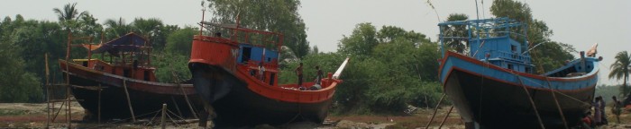
Diamond Harbour was developed by the British East India Company and later by the Empire for its imperial shipping and trade from Kolkata. The region is part of the active Sundarban delta at the mouth of the Hoogly River. Like Diamond the British also developed Caning port in the Sundarbans over the Matla river. Lord Canning’s dream to develop Canning as a port faded as the port suffered from siltation and rise in riverbed in the years after the plan was approved. The last railhead in Canning remains a strong reminder of colonial railway infrastructure at the heart of the Sundarbans, developed to link the hinterland with Kolkata and beyond.
The failure of the Canning Port is testament to the active nature of the Sundarban delta, where silt deposition and erosion constantly changes the landscape with the constant emergence of new islands and the destruction of existing ones.
Diamond Harbour, unlike Canning, is a municipality, initially developed by the British as a fishing and trading port. Today the lighthouse and fort built by the imperial government lie in ruins due to the caving in of the river. The Jetty Ghats are constantly being shifted due to the siltation of the river Hooghly. The phenomenon shapes the whole region. Kolkata’s port has now moved to Haldia, and with siltation in that area there are plans to shift the port further seaward. The construction of the Farrakhan barrage over the Ganges in West Bengal has not helped ships to enter the Kolkata port with progressive siltation of the Hooghly riverbed. This presents a good reminder as how dynamic the active delta of the Bay of Bengal plays its role in shaping river transport.
The Sundarbans are constantly evolving as a littoral landscape with the formation of islands, creeks and active siltation and deposition at riverbanks and islands. The shattered lighthouse and the ruins of the fort present evidence of the changing nature of water bodies and the landmass at the mouth of the world’s largest delta.