Archives for the month of: September, 2013

By Sunil Amrith


Crossing the Bay of Bengal has just been published in the United States by Harvard University Press. It will be available in the UK and in Asia from late October. More information, including a video about the book’s key themes, is available here.


Crossing the Bay combines the work I have been doing for several years on the history of migration across the Bay of Bengal, with more recent research on the region’s environmental history, undertaken as part of the “Coastal Frontiers” project.


The project will continue to delve into the questions that Crossing the Bay raises: questions about how different sorts of environmental change have been experienced in the past; and about what a historical perspective might contribute to understanding the urgent, accelerating effects of climate change—to which the Bay of Bengal’s coastal frontiers are acutely vulnerable.

By Sunil Amrith


Click here for an interesting video by Naimul Haq on Bangladesh’s response to natural disasters. A widely predicted effect of climate change is the increasing intensity and frequency of extreme weather events—to which Bangladesh has been no stranger. Haq’s video discussion examines the effects of Cyclone Mohasen, which struck in May 2013. He points out that loss of life was far lower than in previous cyclones (Alia in 2009, Sidr in 2007): in part this was because Mohasen had weakened by the time it hit land, but Huq argues that this also owes much to Bangladesh’s increasing preparedness and resilience in the face of natural disasters. He emphasizes the efficiency of the evacuation of over a million people in advance of Mohasen, thanks to Bangladesh’s Cyclone Preparedness Programme, which has increased its reach and its capacities over the past three decades.

by Sunil Amrith

Check out Suchitra Vijayan’s important ongoing project, The Borderlands: a photographic documentation of South Asia’s borderlands.


By Debojyoti Das

Diamond Harbour was developed by the British East India Company and later by the Empire for its imperial shipping and trade from Kolkata. The region is part of the active Sundarban delta at the mouth of the Hoogly River. Like Diamond the British also developed Caning port in the Sundarbans over the Matla river. Lord Canning’s dream to develop Canning as a port faded as the port suffered from siltation and rise in riverbed in the years after the plan was approved. The last railhead in Canning remains a strong reminder of colonial railway infrastructure at the heart of the Sundarbans, developed to link the hinterland with Kolkata and beyond.

The failure of the Canning Port is testament to the active nature of the Sundarban delta, where silt deposition and erosion constantly changes the landscape with the constant emergence of new islands and the destruction of existing ones.

Diamond Harbour, unlike Canning, is a municipality, initially developed by the British as a fishing and trading port. Today the lighthouse and fort built by the imperial government lie in ruins due to the caving in of the river. The Jetty Ghats are constantly being shifted due to the siltation of the river Hooghly. The phenomenon shapes the whole region. Kolkata’s port has now moved to Haldia, and with siltation in that area there are plans to shift the port further seaward. The construction of the Farrakhan barrage over the Ganges in West Bengal has not helped ships to enter the Kolkata port with progressive siltation of the Hooghly riverbed. This presents a good reminder as how dynamic the active delta of the Bay of Bengal plays its role in shaping river transport.

The Sundarbans are constantly evolving as a littoral landscape with the formation of islands, creeks and active siltation and deposition at riverbanks and islands. The shattered lighthouse and the ruins of the fort present evidence of the changing nature of water bodies and the landmass at the mouth of the world’s largest delta.

By Debojyoti Das

The Sundarban delta is today fragmented by political boundaries between India and Bangladesh. In undivided Bengal this landscape was the transit route for the flow of goods, ideas and people across the maritime passageways to Bengal plains, Brahmaputra Valley and the foothills of the Himalayas. Soon after partition, refugees moved into the West Bengal borderlands. Both in 1947 and 1971 there was an exodus of Hindus from Bangladesh and Muslims from India.

The arrival of new Bengali immigrants had put pressure on land resources in the Sundarbans and opened up new opportunities of trade, business and employment.

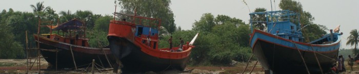
Most of the people who migrated to the Sundarbans belong to the lower caste Namasudras and Pandro Katriyas and are predominantly fisherfolk. Estuary and deep-sea fishing in Bengal gained momentum in the late 1970s with the arrival of Bengal Hindus from Khulna, Jassore, Barisal and Chittagong. These men and women are expert seafarers and their livelihoods depend on marine resources.

During my interviews with fishermen in Kak Dwip I discovered that the fishing industry has transformed the coastal economy of the Sundarbans, triggering a rise in land and commodity prices. The development in Kak Dwip can be assessed from the number of trawlers and fishing nets, which have increased since the late 1970s. The unsustainable growth of fishing has led to the decline of Hilsa and its depletion in the Ganges.

The Aila cyclone of 2009 led to complete destruction of the islands, as salt water swept through the agricultural fields and settlements salinizing the soil. Since 2009, double cropping has stopped and salt water percolation has destroyed every single cash crop grown during the pre-monsoon season. The post Aila period saw new trend in migration: from the village to the city and to the rest of India.  The loss of livelihood led people to migrate to Chennai, Gujarat, and Delhi where they engaged themselves as manual labourers, factory workers, daily wage earners in construction sites and industries. While some families have improved their lot through out-migration, the majority live precarious lives.

Over time, Sundarbans people have adapted to the harsh environment through sheer hard labour and a will to survive. Aila, though devastating, is not an exceptional experience. This hybrid landscape has witnessed many changes and people have adapted over time to these life-churning events.

Check out Bangladeshi photographer Ismail Ferdous’s images of the effects of recent cyclones on the land and its people.